Friday, December 31, 2010

Black Branch GPS Data

A few weeks ago I received a Magellan Explorist 400 GPS from Jeff Barber of Singletracks.com. I've been the number one content contributor to Singletracks for a long time now, and I'll bet he figured that hooking me up with a free GPS (since I'm too much of a mountain bike bum to be able to afford one myself) would be a good investment in his trail maps database.

This new piece of electronic mapping goodness has thrown a ton of fuel on the fire of my mountain bike geekery.  I am getting way too much pleasure of riding around, building maps, and adding waypoints. Of course there is some tangible good that can come out of it: better trail review information for you, and a reduction in the likelihood that you'll get lost when using the data from Greg Rides Trails and Singletracks.com

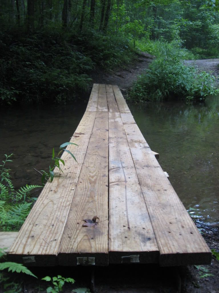
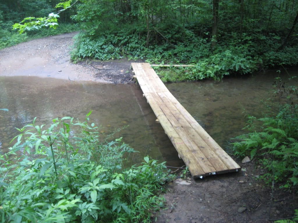
One of the first rides I mapped was the Black Branch / Vietnam / Black Branch Connector combination. The trail had not been mapped on Singletracks yet, and since it was such a good ride I knew it had to be added!

Here are the elevation profile of the ride, an aerial view of the ride, and a link to the actual track file so you can download it to your own GPS:

Elevation Profile


Aerial View


Download the Black Branch GPS map here.

Read more...

Wednesday, December 29, 2010

Singletrack Deprived

Do you ever get sick of mountain biking? Is getting out on the bike and putting in more miles sometimes the last thing you want to do, even though you know you should?

That’s where I’m at right now. I know I should get out and ride because the weather is going to turn nasty tomorrow, but I just can’t seem to make myself do it.


I’m not sure what the issue is. Maybe I just need to spend some time waking up, putzing around the house, and then I’ll be ready to ride. But maybe not…

Sometimes I feel like all I do is mountain bike. Honestly, I get bored with it at times, and I want a change. The simple solution would be to focus on cross training more, but since biking is normally so much fun, I tend to get obsessive and just pedal all the time.

Hmm, let me think about all the rides I’ve done in the past two weeks…

After thinking about it, I don’t think I’ve actually been on singletrack in over two weeks. Maybe that’s the issue! Maybe I’m not bored with mountain biking, I’m bored with grinding around on bland gravel roads.

I am a singletrack addict first and foremost. Singletrack is challenging, entertaining, surprising--everything a forest road is not. Singletrack keeps me coming back for more. Everything is better when the trail is nice and narrow and the rocks and roots abound.

Road bikers: you can keep your smooth pavement, wide lanes, and smoggy traffic! Give me singletrack any day of the week!

In reality, I’m probably not bored with biking in general, I’m simply singletrack deprived. Hmm… I wonder if it’s possible to get bored of singletrack too?

Do you ever get bored with biking? Why or why not?

Read more...

Monday, December 27, 2010

Frady Branch "Trail" System, Toccoa, Georgia

One of the narrowest trails at Frady Branch
According to Jim Parham's guidebook, there used to be about 6-8 miles of singletrack in the Frady Branch Trail System, so I went and rode it. Singletrack? Not hardly! Maybe there used to be singletrack there, but as of November 26th, don't expect to find a single truly narrow trail.

Instead of singletrack, I found trails of 4-6 feet in width that looked as if someone had taken a skidder or bulldzoer through the woods and tried to put in a freaking freeway. Due to the soft nature of the trail surface, the freshness of the machine tracks, and the way the blade had cut into the side of the hill and deposited dirt on the downhill side, I concluded that this machine work had happened less than a month ago on some of these trails.

One of the many nasty, bull-dozed trails at Frady Branch
There is a good chance that at one time there had been quality singletrack here, and that it had recently been bull dozed over as some sort of type of "repair" to fix washed out spots. Well, I can tell you and whoever authorized these "repairs" that your "trails" are going to start washing out with the spring rains. Many of the sections on the steeper hills needed to be rerouted with more bench cut trails and grade reversals. Instead, the dozers went basically straight up and down the hills at an incredibly steep angle. The only erosion control features were a couple of waterbars placed at random intervals, which I find to be a highly ineffectual way to control erosion over the long term. 

Mark my word, unless someone is constantly maintaining these trails, some of the hills will be washed into nasty gullies in the space of 5 or 10 years.


The Plus Side
On a more positive note, Frady Branch does have two redeeming factors. The most prominent is the abundance of historical sites that can only be accessed by bike, horse, or foot. There are numerous old home sites located here in the Lake Russell WMA as well as several sizable cemeteries of over 40 graves just hidden away in the woods.

One of the cemeteries
A grave of some sort in yet another cemetery.
And yes, I looked in through the little whole to see if there was a skeleton
in there:there wasn't. These rocks must just be placed above where
 the body was buried.
The gated forest roads are the second redeeming factor. Consisting of hardpacked dirt with a few rocks, they are fast and hard with several rollers to catch some air off of. 


Bottom Line:
I had more fun on some of the forest roads than I did on the "trails." But if you are in the mood for a ride through history, then you might find Frady Branch enjoyable.

Well-signed "trails"

Navigational Resources
Jim Parham's Off the Beaten Track: North Georgia is a good guide to this route, and the National Geographic map #778 also includes this trail.

The Route

This area is an interconnected trail system, but riding around the perimeter of the trails is a pretty good workout. While the system is well signed, I still recommend carrying the map mentioned above.

Getting There

Getting to the Trailhead:
From Toccoa, head out of town on Currahee Mountain road. Cross straight over 17, and turn left on 184 after 0.5 miles. The trailhead will be on your right 2.5 miles after you make the left hand turn onto 184.

It would be good to note as of November 2010, the trailhead is still closed off. So, I would recommend the following:

Getting to the Upper Trails:
Instead of turning left onto Hwy. 184, continue up the hill and take a left on the gravel Currahee Mountain road near the historic marker. Drive up there until you reach 62A. Park there and start riding.

Your Turn: Do you have more information that needs to be included, or do you have information on new developments since I originally posted this review? If so, please leave a comment and help keep this post up-to-date and as useful as possible.

Read more...

Friday, December 24, 2010

Merry Christmas!

Photo Credit.
I'd just like to wish all of you awesome GRT readers a Merry Christmas! I hope your holidays are filled with fun times with family and friends, great food, and some sweet singletrack (or powder snow)!

Post a comment below and let us know what your plans are for some time in the great outdoors this holiday season! Personally, I've got to ride 65 more miles on my mountain bike if I want to hit 1,500 this year, and I am planning on doing a bunch of downhill skiing up in Wisconsin!

Again, Merry Christmas!

Read more...

Thursday, December 23, 2010

Windy Gap GPS Data

Jeremy was kind enough to email me the GPS file from our ride on Windy Gap. The stats are in:


Total Distance: 4.92 miles
Descending Elevation: 2,517 feet
Descending Distance: 3.17 miles
Climbing Elevation: 677 feet
Climbing Distance: 0.89 miles
Flat Distance: 0.87 miles

Windy Gap Map
Windy Gap Elevation Profile


Download the Windy Gap GPS file here!

This data has already been added to the main Windy Gap trail review.

Read more...

Wednesday, December 22, 2010

Windy Gap Cycle Trail in Ellijay, Georgia: Trail Review

I have ridden many amazing downhills on the back of a mountain bike over the last 5 years. Since receiving a full-on downhill rig from Airborne, I thought that in order to find a descent long enough to truly enjoy it that I would have to travel back out West.

I was so wrong!

I was thoroughly surprised to find a downhill run located east of the Mississippi that was ballsy enough, varied enough, and long enough to qualify as one of the best downhills of my life. Not only that,but it is located in Georgia.

The Windy Gap trail located outside of Ellijay, Georgia is that trail. It is unlike any descent that I have ridden here in the Southeast. The properties that make it such an excellent downhill run are a direct result of the trail being primarily used by motorcycles.

1st Half: Tech
The first half of the trail dropping down off of Windy Gap is a continuous technical assault on your senses and bike's suspension. You will be bombarded by rock-after-boulder-after-rock: this trail is truly worthy of a dual-crown fork and a massive coil-over rear shock. While this trail was challenging, my rig helped me focus on speed instead of simply surviving. So while it was gnarly, Sugar Mountain is still way gnarlier: I felt like I was doing well there by making it down all in one piece!

Boulder Field
Be prepared to do a little bit of pushing through this upper section, as there are a few short climbs scattered throughout. But rest assured: it is well worth it!

As the trail continues down the mountain, it slowly transitions from narrow singletrack rock gardens to a steep section of rocky doubletrack switchbacks. As you crest a short hill after a crazy drop through the switchbacked section, the trail suddenly develops a whole new flavor:

2nd Half: Air and Flow
Windy Gap's second half could not be more different from its first! While the upper section was one massive bone-jarring rock garden, the lower section transitions into a smooth jump run all the way back down to the trailhead.

Taking Off
Every corner I rounded revealed jump after jump that, while they may have been designed as waterbars to control erosion, provided perfect lips and landings with smooth transitions. These jumps felt endless! At a few points I was simply getting too worn out from all of the preloading, popping off the lips, and absorbing all of the landings to really boost some of those jumps to their true potential
Serious Berm!

There were even some moto-made berms of about 8-10 feet in height that were perfect for railing at high speeds!


Bottom Line:
Whoever said that there was no real downhilling in Georgia is just plain wrong. If you are willing to do a little bit of driving, Windy Gap is a very worthy descent!

Video

Windy Gap Part 1: Tech from Greg Heil on Vimeo.


Windy Gap Part 2: Air from Greg Heil on Vimeo.

The Route
We road this trail as a shuttle straight down from the top of the Windy Gap trail to the bottom of it, with no turn offs onto Tibbs or Milma. Read on for driving directions for shuttling.

GPS Data
Jeremy was kind enough to email me the GPS file from our ride on Windy Gap. The stats are in:

Total Distance: 4.92 miles
Descending Elevation: 2,517 feet
Descending Distance: 3.17 miles
Climbing Elevation: 677 feet
Climbing Distance: 0.89 miles
Flat Distance: 0.87 miles

Windy Gap Map
Windy Gap Elevation Profile

Download the Windy Gap GPS file here!

Getting to the Lower Trailhead

From Ellijay, Georgia
  • Head west out of Ellijay on Hwy. 52.Go about 9.2 miles and take a right onto Mulberry Gap road/#18. There will be signs for lake Conasauga. If you reach the Cohutta Overlook you've gone too far. Turn around and take the first left.
  • Drive along Mulberry Gap road a ways.
  • Take a left on Old CCC Camp Roadand keep going about another 6.3 miles.
  • Continue about another mile or two once the road turns back to pavement.
  • Make a right at the sign for the Windy Gap Cycle Trail, up the gravel road (#218).
  • Drive up the road and park in the Windy Gap lot.
From Chatsworth, Georgia
  • Head north out of town on GA Hwy. 2 / 61 / US Hwy. 411. Go about 5.9 miles.
  • Turn Right on Loughridge Road / CR 23.
  • Turn Right on Crandall Ellijay Road / CR 21. 
  • Make a left at the sign for the Windy Gap Cycle Trail, up the gravel road (#218).
  • Drive up the road and park in the Windy Gap lot.
Getting from the Lower Trailhead to the Upper Trailhead
If you are going to shuttle this trail as we did, you now need to leave one car at the lower trailhead and take the other car all the way to the top of the Windy Gap trail. There is no direct way to get there. Despite the fact that the single/doubletrack trail is only 4 or 5 miles long, it is about a 45 minute drive from the bottom to the top, so be prepared to do some driving, especially when you come back to pick up the vehicle you left at the top.

Option 1:
Top of Windy Gap
  • Head back down the gravel road that you drove up to reach the trailhead.
  • Turn right at the pavement. 
  • Turn right onto Mill Creek Road and drive up it about 8.5 miles.
  • Turn right at West Cow Pen Road and drive about 3.2 miles.
  • Take a right on Conasauga Lake Road. Drive all the way to the end, going past the camping area and turn off near Lake Conasauga.
  • Park near the top of the Windy Gap trail.
  • Total distance: about 19 miles.
Option 2:
  • Head back down the gravel road that you drove up to reach the trailhead.
  • Turn left at the pavement. 
  • Head back the way you came to the junction with Old CCC Camp Road and Mulberry Gap road. 
  • Bear left and continue up Old CCC Camp Road.
  • Take a left to stay on Old CCC Camp Road.
  • Take a left on Conasauga Lake Road. Drive all the way to the end, going past the camping area and turn off near Lake Conasauga.
  • Park near the top of the Windy Gap Trail.
  • Total distance: about 20 miles


Navigational Resources
The National Geographic Trails Illustrated map #777 is awesome, and I highly recommend it for all your navigating needs for this ride. This trail will be great for guiding you down the trail, but will also be vital for navigating the back roads as you attempt to reach the lower and upper trailheads. The directions above should help you out with that too, but I still highly recommend buying this map. Jim Parham's Off the Beaten Track also contains the Windy Gap Trail, and it would be a good addition to your pack if you don't already own it.


Your Turn:
Do you have more information that needs to be included, or do you have information on new developments since I originally posted this review? If so, please leave a comment and help keep this post up-to-date and as useful as possible.

Read more...

Monday, December 20, 2010

Windy Gap Video Part 2: Air

Windy Gap Part 2: Air from Greg Heil on Vimeo.


This section of trail was about as close to a groomed downhill run as a I've ever ridden! Every corner I rounded revealed jump after jump that, while they may have been designed as waterbars to control erosion, provided perfect lips and angled landings. There were even some berms nearing 8-10 feet in height! Check the video out above for the proof.

Want to see Part 1: Tech? Check it out here!

Want more info? The in-depth trail review is available here.

Read more...

Friday, December 17, 2010

Windy Gap Video Part 1: Tech


Windy Gap Part 1: Tech from Greg Heil on Vimeo.

I recently shuttled the Windy Gap trail near Ellijay, Georgia with a friend from Singletracks.com. It easily ranks on my list of top ten favorite downhills... and that includes everything that I've ridden in Montana and Colorado!

Part 2: Air will be released on Monday. Want to be alerted immediately when I publish it? Subscribe to the Greg Rides Trails RSS feed!

Read more...

Thursday, December 16, 2010

A Snowy North Georgia Mountain Bike Ride


We were recently having a great conversation on the GRT Facebook Page about mountain biking through the winter, so I thought a little snowy mountain bike stoke was in order!

Read more...

Wednesday, December 15, 2010

The North Georgia Neighborhood: North Carolina and Tennessee

The following is a part of a series on "Everything You Ever Needed to Know about Dahlonega's Outdoor Sports."

View of Fontana Lake, NC
from the Tsali Trail System
One of the cool things about living in Dahlonega is that we have access to plentiful outdoor opportunities right outside our doors, and we also are within easy driving distance of even greater natural resources.  For instance, the North Carolina border is only an hour away, putting the Tsali Trail System at just about 2 1/2 hours away.  Pisgah National Forest is roughly 3 1/2 hours from here, and the Chattanooga, Tennessee area is about 3 to 3 1/2 the other way.


All of those locations hold classic mountain biking! In addition, the Chattanooga area has a heavy saturation of rock climbing opportunities, and Pisgah also contains some great rock to climb.  The Nantahala Outdoor Center located between Dahlonega and Tsali is the place to be for everything whitewater... and it has a nice mountain bike trail, too. As far as hiking and trail running is concerned, anywhere near the Appalachian trail is going to have an abundance of foot-travel-only trails, and since the A.T. winds all across Georgia and North Carolina, you can be sure this entire region qualifies!

The Nantahala Outdoor Center


Series Conclusion

Outdoors sports abound here in North Georgia: mountain biking, road biking, day hiking, backpacking, trail running, canoeing, slow water kayaking, whitewater kayaking, rock climbing, bouldering, and probably more!  The one thing we don't really have access to is a reliable winter season, which I find exceedingly frustrating due to my long-time addiction to powder skiing. So beyond the lack of downhill skiing, cross country skiing, and snowboarding, Dahlonega and the greater North Georgia Neighborhood have got you covered!

Read more...

Monday, December 13, 2010

Paddling Around Dahlonega

The following is a part of a series on "Everything You Ever Needed to Know about Dahlonega's Outdoor Sports."

The Chestatee River
Photo Credit.
The town of Dahlonega is surrounded by several rivers and sizable streams: the Chestatee River, the Etowah River, Yahoola Creek, Cooper Creek, the Toccoa River, and more. It seems like everywhere you turn you're driving across a bridge or overlooking a river!

Since I am not a regular paddler myself, this look at the river culture of Dahlonega is based off of what limited observations I have been able to make, people I have talked to, and the research I have been able to do on the internet.

Canoeing
Down on the Chestatee there are a couple of touristy outfits renting out inflatable tubes to tourists, but thankfully they aren't as plentiful as the tourist outfits over in Helen are. The Chestatee is wide and slow, making it ideal for those tubing businesses as well as canoeing. In fact, one of the rental places, Appalachian Outfitters, rents canoes and kayaks as well as tubes, making it a much more legitimate establishment. One of the parking lots near that business is designated as a public put-in/take-out spot, and I have noticed several other unofficial landing spots along other parts of the river.

The Toccoa River located north of Dahlonega near Blue Ridge is another popular river for canoeing. There are several canoe launches along it, complete with National Forest campsites and bathrooms. Near the Aska area there are several outfitters that also rent canoes if you are looking to try this sport out for the first time or don't want to haul your canoe with you on vacation. More information on canoeing the Toccoa River is available here.

Kayaking
More aggressive whitewater can be found on Yahoola Creek and the Etowah River. The guys that live in the apartment next door to me are totally stoked on whitewater kayaking. During the summertime it seems like their kayaks never leave the backs of their vehicles as they are always out on the water. Based on the short conversations I've had with them about it, Yahoola Creek is one of their favorites.

I also asked Rob S., a GRT reader located nearby in North Georgia who is also an avid whitewater kayaker, what his recommendations would be for some good whitewater kayaking in the area.  Here was his reply:
Here's a quick run down on some of the more frequent runs. You can check them out on the American Whitewater Website.

Upper Amicalola(below 53 Bridge) Class III(IV), Frogtown Creek - Class IV-V, Upper Chattahoochee - Class II, Cartecay - Class II+, Chattooga - Class II-IV(Depending on Section), Overflow Creek - Class IV-V, Tallulah - Class IV/IV+(V+), & Ocoee - Class III+. All are in NE Georgia except the Ocoee. Here is a link to the American Whitewater Georgia Page. It has great beta on our North Georgia Whitewater Rivers....
 There are local canoeing and kayaking opportunities aplenty, and hopefully the information here will help you find some great spots to paddle!

Your Turn: Are you a paddler with more detailed first-hand information about the rivers and streams in the area? Please drop a comment below and give us the low-down!

Read more...

Saturday, December 11, 2010

Jump Photo Sequence

I rode one of the funnest downhills of my life yesterday... and it was here in North Georgia!

A full trail review and several awesome videos are on their way, but for now check out this photo sequence of me airing it out on the Airborne Taka:


And yes, I am a lot higher in the air than I look!

A big thanks goes out to Jeremy for the photos!

Windy Gap DH Part 1: Tech video is now live!

Want more info? The in-depth trail review is available here.

Read more...

Friday, December 10, 2010

The Scoop on Finding Rock to Climb Near Dahlonega

The following is a part of a series on "Everything You Ever Needed to Know about Dahlonega's Outdoor Sports."

Rock Climbing Mount Yonah
Rock Climbing at Mount Yonah.
Climber: Summer. Photo: Syndah Swails.

The closest real rock climbing to Dahlonega is about 45 minutes away at Mount Yonah in Cleveland.  My wife and I have been there numerous times and have gotten to know the those slabby granite cliffs very well!  Many of the bolted sport routes are very easy and beginner friendly, which is good if you're a beginner, but not so good if you are looking to advance your skills.

In addition to the sport routes, there are a number of multi pitch trad routes, as well as a couple of short 5.12s. As a result, Yonah tends to attract a diverse mix of climbers ranging from the very green to the seasoned trad climbers just looking for some slab climbing.

About an hour and a half from Dahlonega is Currahee Mountain in Toccoa, which offers even more granite slab climbing.  There are actually one or two walls with some near-vertical sport routes, but on the whole Currahee is slab.  Almost all of the routes are bolted, and there are many more routes with medium-high difficulty ratings as compared to Yonah.

Bouldering
As a climber, I've naturally done some bouldering and know how to boulder.  Still, I wouldn't consider myself a "boulderer" as I would much rather be ascending a massive cliff than trying to nail a hard problem again and again only 3 feet off the ground.  But from what I have heard, the bouldering opportunities are far more plentiful in the Dahlonega and greater North Georgia area than are the opportunities for true rock climbing.  Based on what I have heard and read on the internet as well as the chalk I've seen on some of the rocks, the area around the top of Blood Mountain (north of Dahlonega just a few miles) has a large boulder field with problems to be worked.  The access hike to those boulders is several miles long, so a much more popular destination is Rocktown, about 2 hours to the west of Dahlonega.

Dahlonega definitely doesn't have a strong climbing community, but if you are into rock climbing and are planning to move to Dahlonega, rest assured that there are a few opportunities to get your hands full of chalk!

Read more...

Wednesday, December 8, 2010

Montgomery Creek Loop: Update

The following is an update which I have added to the Montgomery Creek Loop trail review.

While not nearly the most interesting or challenging trail in the Bull/Jake  Mountain Trail System, Montgomery Creek has certainly been the most dynamic lately.

New Bridge
This past spring some benevolent figure who currently remains a mystery built an excellent wooden bridge across the old metal I-beam to make this stream crossing much more rideable. While the old I-beam was a nice challenge, I definitely didn't feel comfortable risking a cold swim every time I rode this loop.

When ridden in the counter-clockwise direction, this bridge works easily into the flow of the trail. When you approach it going clockwise however, the turn onto the bridge is very sharp. I think that it will be doable with some practice, but I ride this loop counterclockwise about 90% of the time, so it usually flows easily for me.

In my opinion, the new bridge is a welcome addition to this ride! 


Logging
At the time of this update, there is a serious logging operation in progress on the lower end of the loop.  The skidders and logging trucks are utilizing the same doubletrack that this ride runs along for their skidders and log trucks. In fact, they have a big crane set up directly above the gated road for loading trucks with logs.

When I rode through last I was fortunate enough to have the place all to myself, but I have ridden through the vicinity within the past week while on the No Tell trail and could hear them loggers hard at work right next door on Montgomery Creek.

At this time, I'd advise you to avoid Montgomery Creek unless you know that they aren't logging on it at the moment, or unless it's the weekend. It's a shame really, because this time of year when the rain starts picking up and the singletrack remains wet for longer is when we really start frequenting the various forest road rides such as Montgomery Creek. Hopefully the logging will be done sooner rather than later, and we can get back to pedaling through the forest in peace!

The series "Everything You Ever Needed to Know About Dahlonega's Outdoor Sports" will return on Friday.

Read more...

Monday, December 6, 2010

Dahlonega's Famous Road Biking

The following is a part of a series on "Everything You Ever Needed to Know about Dahlonega's Outdoor Sports."

Road Biking
2010 Six Gap Century.
Photo Credit: Lauren S.

Road biking is hugely popular in Dahlonega: way more so than mountain biking. According to many of my road biking acquaintances and articles and websites I've read, many professionals consider "The Gaps" north of Dahlonega to be the best and most challenging road biking in the nation. Here's what Dahlonega Wheelworks, our local bike shop, has to say about the local road riding:

The North Georgia Mountains surrounding Dahlonega are world famous for their beauty and difficulty. The epic climbs up Brasstown Bald, Hogpen Gap, Wolfpen Gap, and Woody's Gap have all been made famous by the Tour de Georgia, as well being the routes for the City of Dahlonega's famous Six Gap Century. Bike riding in Lumpkin County allows you to experience the roads, climbs, and conditions that face UCI Pro Tour riders all within riding distance of Dahlonega Wheelworks' front door. 
A description on Dahlonega.org of the Six Gap Century race held annually in Dahlonega breaks it down with more detailed statistics:
The Six Gap Century’s ultra challenging route takes you up and down six of the steepest climbs in the North Georgia Mountains. Test your stamina with more than 11,200 feet of vertical climbing over the 100 mile course. Elevations for the six gaps in this ride range from 2,949 feet to 3,490 feet. The toughest climb, Hogpen Gap, will test even the strongest riders, averaging a 7% grade for seven miles, with sections as steep as 15%. The Three Gap Fifty’s alternative route offers half the gaps and half the distance, but is nevertheless a demanding and challenging course. Elevations range from 3,109 feet to 3,280 feet.
In addition to all the statistics mentioned above, the Brasstown Bald road is located an hour or so away by car and climbs steeply up to the highest point in Georgia, topping out at 4,784 feet.

Along with the nationally-renowned routes in the area, there is an untold number of unsung highways and paved back roads spidering across the Lumpkin County countryside. People travel to Dahlonega from all over the country to ride road bikes, and as you can see from the testimonials and statistics above, the cycling here is really something else!

Read more...

Saturday, December 4, 2010

A Sneak Peak of the New Airborne Bicycles Dirt Jump Bike

Prototype Graphics
Airborne has just posted some sneak-peak photos of the graphics on the new jump bike. This singlespeed airborne demon has been dubbed "The Wingman." Several of the Flight Crew have already been testing prototype models of this rig, and they all love it! Word on the street is that it will retail for about $749.99.

Check these photos out:

Graphics Option A


Wingman


Dirt Jump Bike


The Wingman


Graphics Option B


The Wingman


Prototype Bike


Airborne Bicycles Jump Bike


What do you think the best graphics combination is? You can have your say by going over to the Airborne Bicycles Facebook Page and dropping a comment with your opinion.

Read more...

Labels

Counter

Blog Archive

About Me

My photo
Greg Heil is the Editor in Chief for Singletracks.com. He's been writing and publishing online since before blogging existed.

About This Blog

Mountain biking, plain and simple. Trail reviews, ride reports, and philosophical musings induced by delirium from grinding up way too many vertical feet.

Read More

  © Blogger templates The Professional Template by Ourblogtemplates.com 2008

Back to TOP