Montgomery Creek Trail (Wahsega) (Doubletrack), Dahlonega, Georgia
Getting There:
From Dahlonega, head from downtown on Highway 60 (North Grove St.) past Lifetime Bikes. Go a couple miles past both of the schools, and then turn left at Camp Wahsega Road and then follow it all the way until it runs into Camp Frank D. Merrill. Turn left, and then left immediately into the parking lot of the white church. Park and ride from there.
Navigational Information:
Pick up the Bull Mountain Trails map (red) printed by Milestone Press as your crucial navigational resource. The National Geographic Trails Illustrated map #777 is awesome as well, and great for navigating all of the forest roads in the greater Blue Ridge WMA area. Jim Parham's Off the Beaten Track also has a well laid-out route for this ride listed under the name "Wahsega."
The Route:
Take a left out of the parking lot, and start heading down the gravel road (#28 or #28-1, depending on which map you're looking at.). The road will take you down past 4-H Camp Wahsega (continue to the right). The road will climb around several curves, and then eventually off to the right there will be a gated doubltrack forest road, #141. From the direction you're currently riding, if you ride right past this gate and go over the rise, there will be another gate on your right, but that doubletrack road eventually leads to/turns into the No Tell Trail. Make sure you get the first gate.
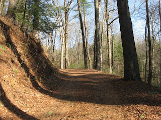
Ride past the gate, and continue riding this old gated forest road. The direction I am describing the route puts most of the climbing into road/trail #141 which you're riding. It is more of a rolling climb in this direction, and is still a fun ride. If you would rather descend this area, then reverse the directions.
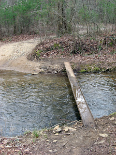
You'll come to a stream crossing with a metal I-beam over it. Cross and continue straight on the road.
Towards the end of the ride there is one major stream crossing. Cross it, don't turn around, and hook up with the pavement in the ranger camp (Camp Frank D. Merrill). Bear up the hill and to the right, until you complete the loop with the gravel road. Turn left on the gravel road (#28) and ride about a quarter/half a mile, and turn right into the church parking lot. After about 9-9.5 miles, you're back at your car.
All About the Trail:
I may have made that route description more complicated than it needs to be, but now there is virtually no way to get lost! The route is really quite simple.
The first thing to know about this ride is that it is not singletrack. Rather, it is old gated doubletrack and mixed with maintained gravel road. I'm including this review in my grand list of trail reviews because:
The only real thing of interest (that I can tell you about) along the length of this ride are the two stream crossings. As I mentioned in the route description, only one of these crossings will require you to actually ride through it if you're trying to stay dry. During the winter when the rest of the singletrack may be wet, it is a pretty sure bet that the last creek crossing will be running pretty deep, and that getting wet will be unavoidable. Especially in the sub-freezing temps of a North Georgia winter, getting soaked is not any fun at all! But, if you ride the route the way I've described it, you'll only be a half mile (at most) from your car after you ford the creek.
Bottom line:
This is a great winter ride that won't destroy the singletrack, and yet is more interesting than riding the main USFS (United States Forest Service for those who don't know) roads.
Update 11/22/10:
While not nearly the most interesting or challenging trail in the Bull/Jake Mountain Trail System, Montgomery Creek has certainly been the most dynamic lately.
New Bridge
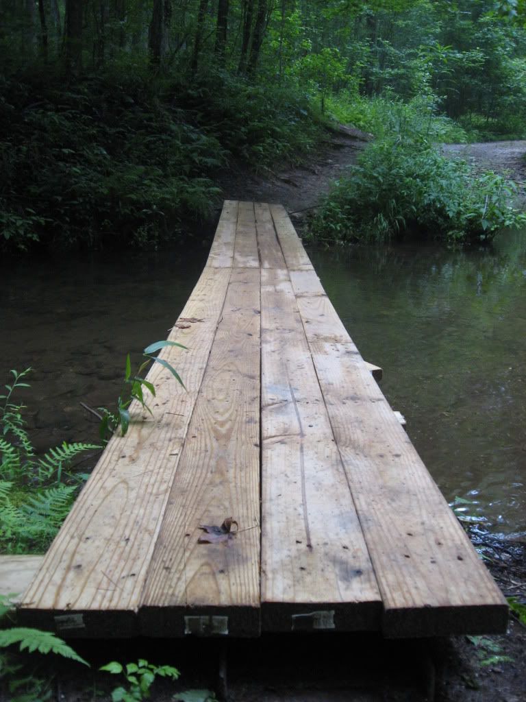
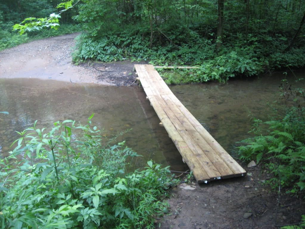
This past spring some benevolent figure who currently remains a mystery built an excellent wooden bridge across the old metal I-beam to make this stream crossing much more rideable. While the old I-beam was a nice challenge, I definitely didn't feel comfortable risking a cold swim every time I rode this loop.
When ridden in the counter-clockwise direction, this bridge works easily into the flow of the trail. When you approach it going clockwise however, the turn onto the bridge is very sharp. I think that it will be doable with some practice, but I ride this loop counterclockwise about 90% of the time, so it usually flows easily for me.
In my opinion, the new bridge is a welcome addition to this ride!
Logging
At the time of this update, there is a serious logging operation in progress on the lower end of the loop. The skidders and logging trucks are utilizing the same doubletrack that this ride runs along for their skidders and log trucks. In fact, they have a big crane set up directly above the gated road for loading trucks with logs.
When I rode through last I was fortunate enough to have the place all to myself, but I have ridden through the vicinity within the past week while on the No Tell trail and could hear them loggers hard at work right next door on Montgomery Creek.
At this time, I'd advise you to avoid Montgomery Creek unless you know that they aren't logging on it at the moment, or unless it's the weekend. It's a shame really, because this time of year when the rain starts picking up and the singletrack remains wet for longer is when we really start frequenting the various forest road rides such as Montgomery Creek. Hopefully the logging will be done sooner rather than later, and we can get back to pedaling through the forest in peace!
From Dahlonega, head from downtown on Highway 60 (North Grove St.) past Lifetime Bikes. Go a couple miles past both of the schools, and then turn left at Camp Wahsega Road and then follow it all the way until it runs into Camp Frank D. Merrill. Turn left, and then left immediately into the parking lot of the white church. Park and ride from there.
Navigational Information:
Pick up the Bull Mountain Trails map (red) printed by Milestone Press as your crucial navigational resource. The National Geographic Trails Illustrated map #777 is awesome as well, and great for navigating all of the forest roads in the greater Blue Ridge WMA area. Jim Parham's Off the Beaten Track also has a well laid-out route for this ride listed under the name "Wahsega."
The Route:
Take a left out of the parking lot, and start heading down the gravel road (#28 or #28-1, depending on which map you're looking at.). The road will take you down past 4-H Camp Wahsega (continue to the right). The road will climb around several curves, and then eventually off to the right there will be a gated doubltrack forest road, #141. From the direction you're currently riding, if you ride right past this gate and go over the rise, there will be another gate on your right, but that doubletrack road eventually leads to/turns into the No Tell Trail. Make sure you get the first gate.
Ride past the gate, and continue riding this old gated forest road. The direction I am describing the route puts most of the climbing into road/trail #141 which you're riding. It is more of a rolling climb in this direction, and is still a fun ride. If you would rather descend this area, then reverse the directions.
You'll come to a stream crossing with a metal I-beam over it. Cross and continue straight on the road.
Towards the end of the ride there is one major stream crossing. Cross it, don't turn around, and hook up with the pavement in the ranger camp (Camp Frank D. Merrill). Bear up the hill and to the right, until you complete the loop with the gravel road. Turn left on the gravel road (#28) and ride about a quarter/half a mile, and turn right into the church parking lot. After about 9-9.5 miles, you're back at your car.
All About the Trail:
I may have made that route description more complicated than it needs to be, but now there is virtually no way to get lost! The route is really quite simple.
The first thing to know about this ride is that it is not singletrack. Rather, it is old gated doubletrack and mixed with maintained gravel road. I'm including this review in my grand list of trail reviews because:
- It is listed in Jim Parham's Off the Beaten Track
- It is a really good ride for when the singletrack is wet. Ride the wide doubletrack and avoid doing more damage to our precious singletrack trails!
- Even though it isn't singletrack, this is really a fun route!
The only real thing of interest (that I can tell you about) along the length of this ride are the two stream crossings. As I mentioned in the route description, only one of these crossings will require you to actually ride through it if you're trying to stay dry. During the winter when the rest of the singletrack may be wet, it is a pretty sure bet that the last creek crossing will be running pretty deep, and that getting wet will be unavoidable. Especially in the sub-freezing temps of a North Georgia winter, getting soaked is not any fun at all! But, if you ride the route the way I've described it, you'll only be a half mile (at most) from your car after you ford the creek.
Bottom line:
This is a great winter ride that won't destroy the singletrack, and yet is more interesting than riding the main USFS (United States Forest Service for those who don't know) roads.
Update 11/22/10:
While not nearly the most interesting or challenging trail in the Bull/Jake Mountain Trail System, Montgomery Creek has certainly been the most dynamic lately.
New Bridge
This past spring some benevolent figure who currently remains a mystery built an excellent wooden bridge across the old metal I-beam to make this stream crossing much more rideable. While the old I-beam was a nice challenge, I definitely didn't feel comfortable risking a cold swim every time I rode this loop.
When ridden in the counter-clockwise direction, this bridge works easily into the flow of the trail. When you approach it going clockwise however, the turn onto the bridge is very sharp. I think that it will be doable with some practice, but I ride this loop counterclockwise about 90% of the time, so it usually flows easily for me.
In my opinion, the new bridge is a welcome addition to this ride!
Logging
At the time of this update, there is a serious logging operation in progress on the lower end of the loop. The skidders and logging trucks are utilizing the same doubletrack that this ride runs along for their skidders and log trucks. In fact, they have a big crane set up directly above the gated road for loading trucks with logs.
When I rode through last I was fortunate enough to have the place all to myself, but I have ridden through the vicinity within the past week while on the No Tell trail and could hear them loggers hard at work right next door on Montgomery Creek.
At this time, I'd advise you to avoid Montgomery Creek unless you know that they aren't logging on it at the moment, or unless it's the weekend. It's a shame really, because this time of year when the rain starts picking up and the singletrack remains wet for longer is when we really start frequenting the various forest road rides such as Montgomery Creek. Hopefully the logging will be done sooner rather than later, and we can get back to pedaling through the forest in peace!


9 comments:
Looks like perfect Gravel Grinder country!
Oh yeah, it's fun! Good winter-time riding.
You should have included a picture of the 30 foot water fall that runs along side the trail. I rode there a couple of weeks ago and saw a whole pack of wild boar!
A pack of wild boars... that's crazy!
This review is mainly for the gated road loop, but it does need some updating. The water fall is over on what some refer to as the "bee trail." Haven't decided yet how much info I want to post on unmarked trails... although some of them are awesome, and the waterfalls down in there are gorgeous! One of the times I rode in there I ended up crossing that river and it was almost waist high... Very cool stuff!
So I may need to go grab some pictures of that area, or if you have any, feel free to shoot them my way.
You could include this route with black branch and start from the church across the street from the ranger camp. I use to do this route alot. You just double back on it on the way back to the car or take camp wahsega road which has nice little grind at the end back to the car.
Laxson OUT
Yeh, there's an endless amount of ride variations out there which is one of the reasons I enjoy this area! The Bee Trail is a nice addition to the Montgomery creek loop too, since you basically have to ride both of them together. I've been meanin\g to write up a review for that trail.
I actually did this ride today, and there's some serious logging going on on this road. They've got a big crane set up right next to the road for loading... no one was there today, but I'd hate to ride through when there are all sorts of massive machines running around.
Do they have a bridge across that river crossing now when you get down near the airfield at the ranger camp
Yeah there's been one there for at least a couple of years now, although when I wrote this initial review I may not have known about it yet. When dropping down into Ranger Camp on the blacktop, pass the gym on the right, hang a right past the other rec stuff and the bridge is in the woods over the stream and pops out on the other side near a pavilion beside the air field. Then, follow the gravel road around to the left, and hang a right on the Montgomery Creek Loop.
This post has been updated.
Post a Comment