The Black Branch, Vietnam, and Black Branch Connector Trails, Dahlonega, Georgia

Black Branch
Compared to the other areas in the Bull Mountain trail system, this loop has a relatively high concentration of true singletrack. Much of the mountain biking in the Dahlonega area requires forest service roads or wide doubletrack to connect the singletrack gems into a cohesive ride.To an extent, this is also true for the Black Branch loop, but it does contain roughly 6-8 miles of nearly uninterrupted, narrow singletrack.
 |

When I decided to ride this trail again a little over a week ago I was finally able to locate the Vietnam Trail (so-called by some), and I think that discovery made a world of difference in the level of enjoyment I got out of this ride. The Vietnam Trail is a spur off of the standard Black Branch loop that can easily be worked into the flow of the ride, adding a couple of quality miles of singletrack. It is well worth the time!

 |
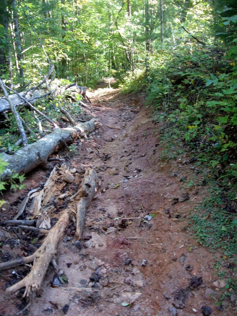
| Tough Obstacle |
This experience of wandering off the beaten track for a few miles into the heart of the North Georgia forest is a rewarding one! I personally love trails of this kind that are very rideable, and yet provide a distinct feeling of adventure and discovery as you roll along them. So when you are out mountain biking the Black Branch loop, do some exploring and tack on the Vietnam Trail as well!
Bottom Line: These trails have great quality singletrack with fewer monster climbs, far-removed from the road for a true deep-woods mountain bike experience!
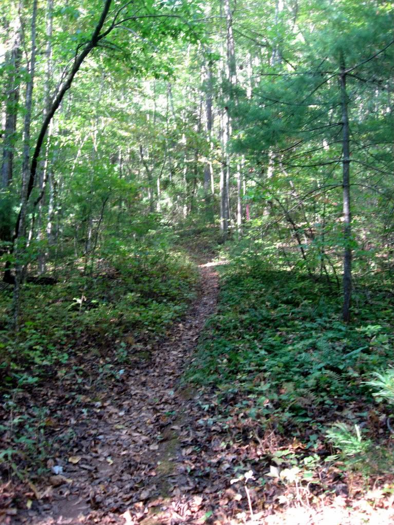 |
| Black Branch Trail |
The Route
As I mentioned above, Black Branch is set up basically as a loop. It can be ridden either direction. However, here is my recommended route:
- Begin at the end of the Jake Mountain trail where it joins FS 28-1 (or ride up the Jake Mountain trail from the lower parking lot). Back track down it across the stream, and hang a left up the Black Branch Connector Trail.
- Hang a right on the first gravel road that you hit, and ride straight until the obvious junction.
- Head in left at the sign to begin the Black Branch loop.
- The trail drops quickly down a steep section of doubletrack full of large water bars. Catch some air! (But don't run off the side.)
- Keep a sharp lookout to your left for the beginning of the Vietnam trail. If you cross the creak at the bottom, you've gone too far. Back track uphill a couple of feet to pick up the trail.
- Ride the Vietnam trail, and enjoy the rustic singletrack experience! Watch out for the creek crossings.
- When you return to the main Black Branch trail, hang a left and continue around.
- At one point there will be a fork in the trail. Both options bring you back to the same location very quickly. Right is high and flat, left is low and not so flat.
- The end of the loop appears pretty abruptly. As the trail widens out, you'll be faced with a metal barrier at the end of the trail. Hang a left on the Black Branch Connector Trail before you get there.
- Cross the gravel road from #2 and pick up the last section of the Connector Trail that you rode in #1. Now the loop is really complete.
- Hang a right at the Jake Mountain trail and pop back out on FS-28-1 (or turn left to go down the Jake Mountain trail if you climbed up from the lower parking lot).
The maps that I have come to live by are all a part of the National Geographic Trails Illustrated series. Easy to read, almost always up to date, tear resistant and water proof, these maps are designed to ride in your Camelback for months on end! #777 contains all of the Dahlonega-area riding.
Off the Beaten Track: North Georgia by Jim Parham is an excellent guide book for all the mountain biking in Northern Georgia which I have used extensively. This is usually the first resource I consult when traveling to a new place. If you enjoy traveling to new locations to mountain bike, I highly recommend it.
GPS Data
Elevation Profile

Aerial View

Download the Black Branch GPS map here.
This map is designed to show where the trail is. After following the entire track and completing the loop at the end of the lariat, return to your car by retracing the singletrack that you began on.
Getting There
From Dahlonega, Georgia head West out of town on Hwy 9. Take a right onto Hwy 52, and then 4.6 miles later take a right onto Nimblewill Church Road at the old Grizzle's Country Store.
If you are planning on adding in the Jake Mountain trail, take a right off of Nimblewill Church at the sign for the Jake Mountain parking lot.
If you just want to ride the black branch trails, continue past the Jake Mountain parking lot a mile or so, and take a right onto FS 28-1. Follow the road up, and don't turn towards Bull Mountain. At the big fork in the road, continue to follow 28-1 and do not turn up 77a. Drive down the hill, up and down the next hill, past the Turner Creek trail at the bottom, up and down the next hill and park near the end of the Jake Mountain trail, which hits the road on the right in that valley. Start riding (see "The Route" section above).
Your Turn: Do you have more information that needs to be included, or do you have information on new developments since I originally posted this review? If so, please leave a comment and help keep this post up-to-date and as useful as possible.

2 comments:
I haven't ridden this trail in years and I'm thinking about riding this trail this saturday to throw in a little pace change from training for the 6 race next Saturday. Nervous are starting to build!!! LOL
Les Laxson
This trail is in fine condition right now. I was just out there last week and cleared out about a half a dozen downed trees on it, so it's ready to rip!
Post a Comment