Bennett Gap (Trail #138), Pisgah National Forest, Brevard, North Carolina
 |
| Mountain laurel on the Bennett Gap Trail. |
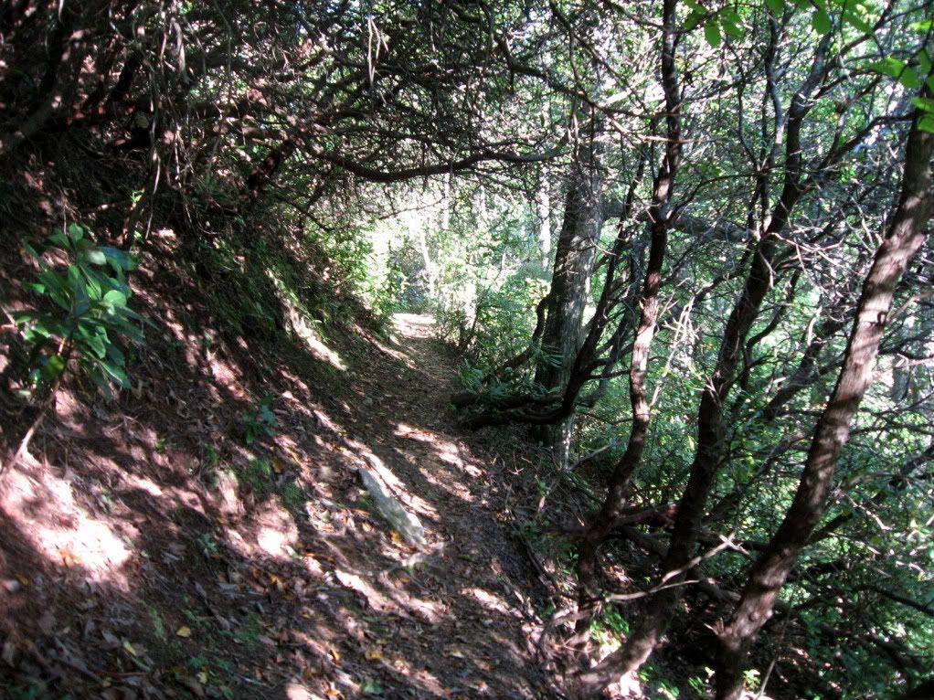
The lower section which climbs from USFS road #477 up to Coontree Gap is much more climbable on a mountain bike than many of the other trails in the immediate vicinity. Beginning at a bridge spanning a rushing stream, the singletrack roughly parallels the stream as it gains elevation along the deeply forested northern aspect of the ridge.
 |
| Looking back down a short section of Satan's Staircase. |
Side note: Here in Georgia we have very few (if any) true hike-a-bikes. In Montana, Colorado, and apparently North Carolina, humping it up the hill with your bike on your back is almost a sport in its own right and is an integral part of the mountain biking experience. So many people no longer have an appreciation for a good hike-a-bike, or never had one to begin with. It is satisfying to know that grueling trails such as this one exist here in the Southeast.

Further down the ridge the trees open up into a large ridge-top meadow. Timm Muth mentioned how beautiful this meadow was in his guide book, but when I tried to ride through it it was a massive, overgrown field of thornbushes. The trail was so overgrown that I had to walk just to squeeze through, and I still ended up with several long scratches from the clawing, thorny hands.
The View
The crown jewel of the Bennett Gap trail is easily the views from the top of the ridge. At first, glimpses of the surrounding forest start to appear through the trees, and then eventually you crest the top of a knob and are suddenly presented with a stunning 360 degree view of the surrounding Pisgah National Forest. It is awe inspiring!
 |
| Looking Glass Mountain |
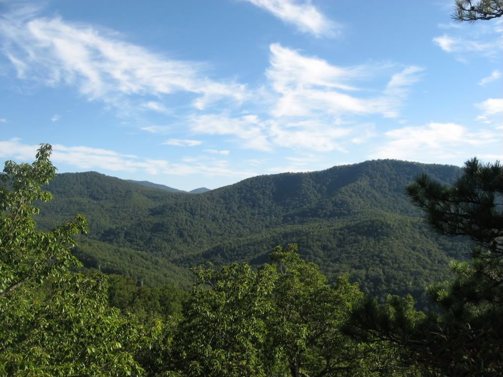 |
| Pisgah National Forest |
Bottom Line: Riding these remote trails through the North Carolina wilderness is a truly rewarding experience, if you can handle the steep hike-a-bikes.
Navigational Resources
Timm Muth has written an awesome guidebook with detailed statistics and directions. It includes almost all of the worth-while trails in North Carolina, and features a big section on the Tsali trails. If you're planning on spending a lot of time in NC, this is a great investment! The Bennett Gap Trail is included in this book as a part of the Big Avery loop. | |
The maps that I have come to live by are all a part of the National Geographic Trails Illustrated series. Easy to read, almost always up to date, tear resistant and water proof, these maps are designed to ride in your Camelback for months on end! #780 contains all of the Brevard-area Pisgah National Forest: |
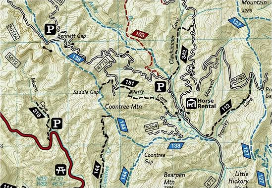 |
| From map #780 |
Getting There
Either connect to it from the Coontree Gap Trail, or:
From Brevard, head north on Highway 64, and then take a left on US. Hwy. 276 which leads into the heart of Pisgah National Forest. Go a mile or two, and hang a right down USFS Road #477. Drive down it a couple of miles, and the Bennett Gap trail will start on the left immediately before a bridge crossing a big stream.
Your Turn: Do you have more information that needs to be included, or do you have information on new developments since I originally posted this review? If so, please leave a comment and help keep this post up-to-date and as useful as possible.

6 comments:
Looks like an epic ride! The remoteness of this location is extremely appealing to me and, I'm sure, to other outdoor enthusiasts. To be surrounded by nature like that is something that can be enjoyed in itself - When combined with some good single track, this system has to be a worth-while use of time.
Nice review, good descriptions, I can't view the larger versions of most of the trail pictures though :/
-AJ
Yes, I definitely loved the remoteness!
Sorry about that mess up. There's some fluke in the normal editor that causes that, but when I use the beta version it works. Think I wrote this post in the main non-working one. Though, try clicking on the linked caption instead, that should work ATM.
I'll try to see if I can fix the images though.
-Greg
I went in and manually fixed them. Those first several look way cooler blown up.
Bennett Gap is definitely a classic trail in Pisgah, most locals run it the opposite way, climbing up 477 then taking the fast and steep way down. Also, this is a seasonal trail which is closed April 15- October 15th.
Hey Davis, thank you so much for the info on that alternate route. Makes a lot of sense! I will probably add that in to the main post. I went and looked on the map, and I see the half brown/half white box for Coontree Gap (& on a lot of the other trails), but I don't see one for the Bennett Gap trail.
Obviously though, you know way more about the area than I ever will!
Post a Comment